See my blogs:
Danny Ricketts Blogger blogs:Ā http://www.blogger.com/profile/09384259856105465851
Danny Ricketts WordPress blogs:Ā http://rdricketts.com/blog/about/
History Posters -Danville, Pittsyvlania Co. VA

This is a part of the Clay Poster (No. 24) Āshowing a map of a large 9,600-acre land grant beginning above the Main St. Bridge in Danville an north to the ridge of the White Oak Mountains.Ā $5.00 (Large)Āplus actual postage.Ā For detail cut and paste htmls.
Posters, Charts and Historical Charts by Robert ōDanny??? Ricketts
102 Parrish Road Phone: 434-792-4943
Danville, VA 24540 Email: dan@rdricketts.com
SHIPPING & Handling: Priority Mail $5.00. Additional posters are shipped at no extra charge in the same mailing. Large posters are rolled in a large triangular priority tube; smaller posters are shipped in a priority box.
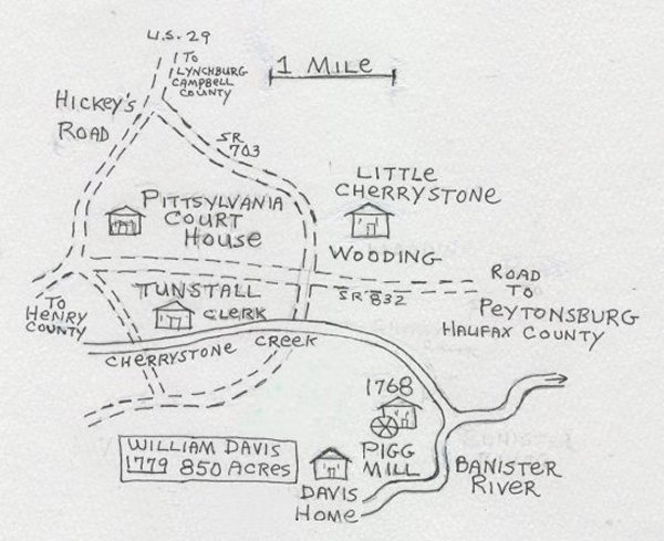
1. William ByrdÆs 1728 Survey of Boundary Line Va-NC Map with campsites, entries from ByrdÆs diary, area in Pittsylvania Co. in the Danville area. 11? X 14?. $3.00
2. Main Street/Canal area of Danville, Virginia in 1871 showing covered bridge and 1796 Mill. Limited printing of 500 copies, each signed and numbered by artist Danny Ricketts in 1993. The original site for the beginning of Riverside Cotton Mills (now Dan River Inc.) is traced back to the original land grant. 11?X14?. $3.00
3. Danville, Virginia 1819 Property Owners for the first 119 lots shown on map. Name and date of purchase of the first lots sold beginning in 1796. Much more historical information. 11?x14?. $3.00
4. Danville, Va. Property owner tax lists for 1797 and 1819. Exact copies of the original hand written court records. 11?X 14.5?. $3.00
5. Map of Lots in Danville, Va. 1877 showing businesses and property owners. 11?X17.5?. $3.00
6. Capt. John & William Dix, Revolutionary War Patriots. Much history about Pittsylvania Co. including a list of the 30 members of the Committee of Safety, Oath of Allegiance, List of the 27 Revolutionary War Captains, Lieutenants, and Ensigns. Dix claims at the Court of Claims including hundreds of soldier, horses, and wagons transported across Dan River at DixÆs Ferry. 11?X14.5. $3.00
7. Porter Flagg (b 1808 Mass.) Stagecoach Driver. Early Free Black Property Owners. Flagg Island. Maps of Flagg Island and property on Dan River. 11? X 14?. $3.00
8. Stage Line Map circa 1830. Milton NC to Fredericksburg Va. Cross Stages to Danville, Lynchburg, Richmond, Orange Court House, Charlottesville Goochland Court House. The line continued to Powelton, Georgia. List of distances between taverns and Court Houses. 1830Æs woodcut of stage. 11? X 13.5? $3.00
9. Historical Map Danville, Virginia area. Roads Streams Houses Mills. Entries from President George WashingtonÆs Diary: crossed Dan River here in 1791. 11? X 14? $3.00 (#20 below is a larger revised edition of this poster)
10. Land Grants Danville Va area. William Wynne (3,500 acres) photo of his WynneÆs 17th century 200 lb iron family chest from England is on poster. Other land grants include Nathaniel Terry, Absolom Bostick, Thomas Barnett, John McClain, William Travis, John Armstrong, Lewis Green (Chiswell), John Boyd, Edmond Floyd, John Cargill, William Hogan, and William Cornelius. Info on Indian Villages, First Blacks, Water Powered Grist Mills (WynneÆs Mill c 1754). 17.5? X 22.5? $5.00 http://rdricketts.com/scans/10wynne.jpg
Detail: http://rdricketts.com/scans/10wynneb.jpg
11. Col. John DonelsonÆs migration from Pittsylvania Co. to Nashville, Tennessee area in 1779. Map shows parts of Virginia, Kentucky, Tennessee, North Carolina Georgia, Alabama, Missouri, and Illinois. Donelson was in charge of about 30 boats with 40 families who traveled by water 985 miles down the Holston, and Tennessee Rivers and up the Ohio and Cumberland to Nashville. Capt. James Robertson led men and animals over land to meet the others there. Over 100 names of the early setters. Entries from DonelsonÆs Diary of the trip. Daughter Rachel, born in Pittsylvania Co., was 12 years old during the trip and later married President Andrew Jackson. 17.5? X 22.5? $5.00 http://rdricketts.com/scans/11donelson.jpg
Detail: http://rdricketts.com/scans/11donelsonb.jpg
12. 1850 Historical Map of part of Pittsylvania Co. Roads Streams Houses Mills. Chalk Level, Mt. Airy, Markham, Sonans, & Greenfield Church. NE of Chatham, the county seat. 11? X 17? $5.00 http://rdricketts.com/scans/12chalklevel.jpg
Detail: http://rdricketts.com/scans/12chalklevelb.jpg
13. Last Capital 1865 Map. Danville showing the location of houses where the Confederate Cabinet stayed at the time of the surrender at Appomattox Court House. Sutherlin Mansion & Prisons where thousands of Union Soldiers died. 11? X 22? $5.00
http://rdricketts.com/scans/13danville1865.jpg
Detail: http://rdricketts.com/scans/13danville1865b.jpg
14. 80 Indian Tribes of Virginia & 127 Powhatan Villages named. 17? X 22? $5.00
http://rdricketts.com/scans/14indiantribes.jpg
Detail: http://rdricketts.com/scans/14indiantribesb.jpg
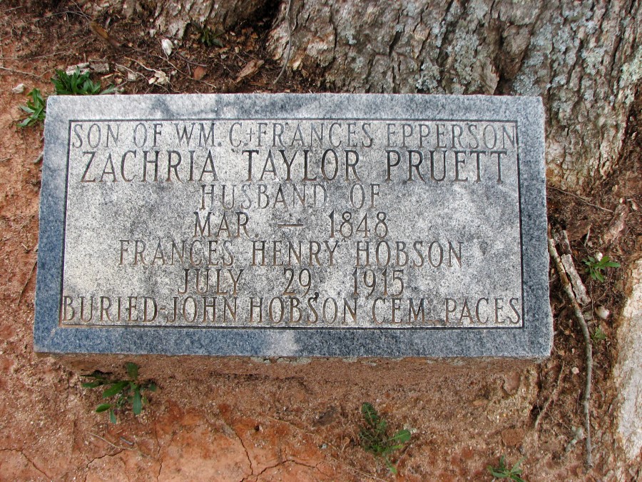
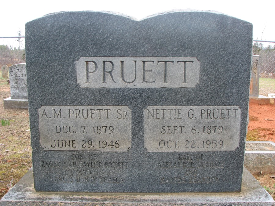
15. Dan River Plantations & Mills 20 sketches with Historical Info. DanÆs Hill, Berry Hill, Ferry Farm, Briarfield, Oak Hill, Oak Ridge, Laurel Cliff, BachelorÆs Hall, Belle Grade, Bridgewater, Ferry Farm, Homes of Wm Bean, Nicholas Perkins, Thos. Harden Perkins, Wm Wynne, Robt Payne, John Dix, Joseph Motley, Thomas Fearn, John Dix Ordinary, Barnett & Townes 1796 Grist Mill, & Wynnes 1754 Grist Mill. History of each.Ā Dan’sĀHill is one of the plantations.Col. Thiis was the home of Robert Wilson (b 24 Jan 1789 d 1873), who married Catherine A. Pannill. The children I have listed are John, George, Samuel Pannill, Robert A., William, Maria C., Mary D., Caroline (married Redd) Wilson, Harriet A. (married Cunningham). Not all of the children are named in his will, which was presented, to the court on 17 Nov 1873. The DanÆs Hill home tract of 1,562 acres was willed to his son Robert A. Wilson. The ōSandy River Tract??? of 1,900 acres was divided between daughters Harriet A. Cunningham and Caroline E. Redd. The ten-acre ōScarceÆs Mill Tract??? of ten acres went to son Robert A. Wilson. Son Samuel P. Wilson had been ōalready advanced an equal portion of my estate.???
Ā17.5? X 22.5?. $5.00
http://rdricketts.com/scans/15plantations.jpg
Detail: http://www.rdricketts.com/scans/15plantationsb.jpg
http://rdricketts.com/scans/15plantationsc.jpg
16. Samuel HarrisÆ Fall Creek Plantation. Pittsylvania County, VA. Survey of 6,592 acres. Col. Samuel Harris commanded Fort Mayo during the French & Indian War and was present when George Washington inspected in 1756. 17.5? X 22.5?. $5.00
http://rdricketts.com/scans/16harris.jpg
Detail: http://rdricketts.com/scans/16harrisb.jpg
17. Lynchburg Republican June 23rd 1845. Newspaper reprint. Death of President Andrew Jackson reported. Andrew JacksonÆs wife, Rachael Donelson, was born at Markham in Pittsylvania County. In this newspaper it is said that the President was laid to rest at the Hermitage, Nashville, Tennessee. (See # 11 above ¢ about John Donelson, RachaelÆs father, and their migration to the Nashville area in 1779.) 23 in. x 35 in. (actual size of the original newspaper) $5.00
http://rdricketts.com/scans/17republicnp.jpg
Detail: http://rdricketts.com/scans/17republicnpb.jpg
18. Principal Engagements of the Civil War. Location, dates, Commanders and Men Engaged. 16 inches x 20 inches. $5.00
http://rdricketts.com/scans/18engagements.jpg
Detail: http://rdricketts.com/scans/18engagementsb.jpg
19. Danville, VA Railroads 1910. Richmond & Danville, Lynchburg & Danville, The Piedmont, Danville & Western (ōDick & Willie???), Atlantic & Danville, Danville Street Car Co., Words to the ballard ōWreck of the old 97???, photos of wreck. 17.5? x 22.5? $5.00
http://rdricketts.com/scans/19railroads.jpg
Detail: http://rdricketts.com/scans/19railroadsb.jpg
http://rdricketts.com/scans/19railroadsc.jpg
20. President George WashingtonÆs Southern Tour 1791 ¢ Entries are shown from George WashingtonÆs Diary beginning June 1, 1791. Areas shown are Danville, Virginia; part of Pittsylvania County, Virginia; and Caswell County, North Carolina. George Washington spent the night of Friday, June 3, 1791, at the Whit Gatewood house, crossed on Dix Ferry, and had lunch at DanÆs Hill with Colonel John Wilson, who was County Lieutenant during the Revolutionary War. Shown on the map are Laurel Cliff, Bridgewater, Bellegrade, and the homes of Thomas Fearn, Joseph Motley. Also shows WaltersÆ Mill, Dix Mill, WynneÆs Mill, Townes & BarnettÆs Mill, WorshamÆs Mill, BryantÆs Mill (KeenÆs Mill), BeaverÆs Mill, ClarkÆs Mill. Also shown are roads and waterways. 17.5? x 22.5? $5.00
http://rdricketts.com/scans/20washington.jpg
Detail: http://rdricketts.com/scans/20washingtonb.jpg
21. Danville, Virginia in 1829 Drawing based on Thompson ColemanÆs writing concerning early homes and businesses of Danville. This is the area from Grove Street Cemetery (c. 1827) down to the canal and Dan River. Residences of Capt. James Lanier (first mayor of Danville), John Ross, George Price, John W. Paxton, Capt. William Linn, Capt. John Noble, Robert Payne Esq., Samuel Patton, General B.W.S. Cabell (his son, Confederate General William Lewis Cabell, was born in this house and was later mayor of Dallas, Texas), Letha Flagg (free mulatto woman and ancestor of the late Rev. Doyle Thomas), Dr. Nathaniel T. Green, and many others. Some of the businesses shown on poster are: the newspaper ōThe Reporter???; William F. Russell, Tailor; Bell Tavern (later a bank where part of the Confederate gold was kept during the time Danville was the last capital of the Confederacy); Robert CarterÆs Hatter Shop; Tan Yard; Market House; PannilÆs Tobacco Warehouse; Saw Mill with Sash Saw; Flour Mill; Mill with stone for grinding; Linseed Oil Mill with a cotton gin and wool carding machine; Roanoke Navigation Company Canal; Williams Tavern; Dye House; and many more. 11? x 14? $3.00
http://rdricketts.com/scans/21danville1829.jpg
Detail: http://rdricketts.com/scans/21danville1829b.jpg
22. Capt. John Noble (1785-1858) Estate in North Danville, VA, listing his children and dates. John Noble was born on November 14, 1783 in Boston, Massachusetts. His father was lost at sea and his mother moved to Petersburg, Virginia before 1796. He was apprenticed to a shoemaker. Some time before 1807, he ran away and settled in Danville. In Nov. of 1821, he bought out Henry NealÆs Shoe Shop. He became wealthy and a large land owner. When Capt. Noble died in 1855 he owned 240 acres north of the Toll Bridge (Main Street). The Richmond and Danville Railroad, completed from Richmond in 1856, is shown on the map (the original was prepared in distribution of his property). The western boundary of the property is the Danville, Franklin and Botetourt Turnpike, which went 93 miles to Fincastle. The first five miles was completed in 1839 by contractor Robert Townes of Danville. There are many tidbits of historical information about this area of what is now Danville. The location of the old Worsham burial ground is shown. 17.5? X 22.5?. $5.00
http://rdricketts.com/scans/22noble.jpg
Detail: http://rdricketts.com/scans/22nobleb.jpg
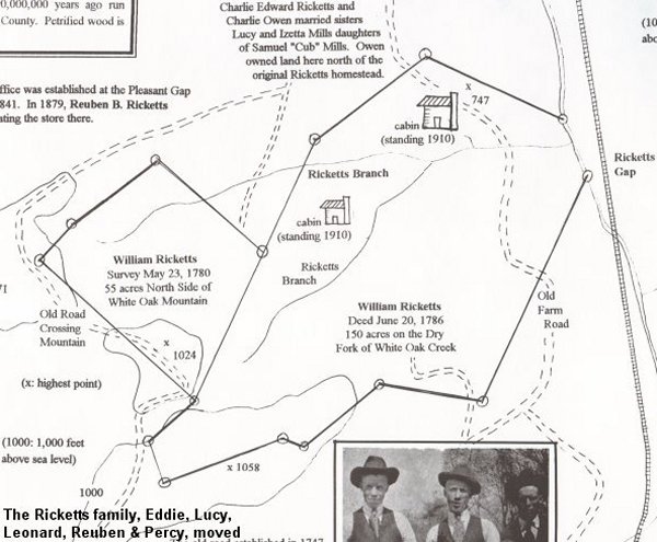
23. Ricketts Land Grant and Homestead at Dry Fork, VA 1780 (near White Oak Mountain) History of the Town of Dry Fork. Ten generations of Ricketts in Pittsylvania County (photographs of six generations). Early records misspell the name ōRickles.??? 17.5? X 22.5?. $5.00
http://rdricketts.com/scans/23wmricketts.jpg
Detail: http://rdricketts.com/scans/23wmrickettsb.jpg
24. Charles Clay Land Grant survey 1755. 9,600 acres from Dan River in Danville to the crest of White Oak Mountain along the Franklin Turnpike. Much Clay family genealogy. 17.5? X 22.5?. $5.00
http://rdricketts.com/scans/24clay.jpg
Detail: http://rdricketts.com/scans/24clayb.jpg
25. Confederate Hospitals Danville, VA. Locations of hospital buildings and list of about 700 men who died there during the Civil War. Poster shows a Map based on drawing made by FreedmenÆs Bureau in 1865. These Confederate buildings were confiscated at the end of the Civil War. The complex of thirty buildings shows eighteen numbered buildings to be sold as ōnot of use to the military or government.??? One of these buildings was later used for the first Black church in Danville. The High Street Baptist and Loyal Baptist Church congregations came from this first church. 17.5? X 22.5?. $5.00
http://rdricketts.com/scans/25confedhospitals.jpg
Detail: http://rdricketts.com/scans/25confedhospitalsb.jpg
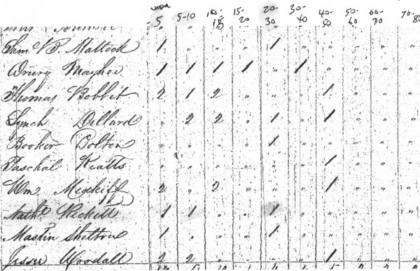
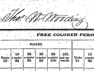
26. Confederate soldiers named Ricketts (Ricket, Rickets, Ricket, etc.). 136 names of soldiers 1861-1865 with rank, company, regiment and state. 17??? x 22???. $5.00
http://rdricketts.com/scans/26confedricketts.jpg
Detail: http://rdricketts.com/scans/26confedrickettsb.jpg
27. ōRoanoke Navigation Co. Danville, VA., Bateau Passage & Water Power???. Map of Danville showing the 3,200-foot long canal with four locks, which was completed in 1824. Several old maps are pictured including 1. A very early map of Winns (Wynnes) Falls and Dan River along the VA/NC line. This is prior to 1793 when the Va. Legislature established Danville. 2. A map prior to 1824 when the millrace was converted to a canal for bateau. Shows the 1796 mill of Barnett & Townes and the Old Saw Mill. 3. An 1854 map showing the Toll Bridge, the Basin, and three of the four locks (each 90 feet long). 4. An 1877 map of the Free Bridge and canal. 5. Drawing of the old mill near the locks. The Roanoke Navigation Co. completed the canal around the ōGreat Falls??? or ōWynnes Falls??? in 1824. The canal system here at Danville, Virginia extended the navigation from the Atlantic Ocean in the area of Roanoke Island/Nags Head, North Carolina up Dan River another 65 miles to Danbury, North Carolina. The Danville Canal system was 3,200 feet long, 30 feet wide and 3 feet deep. There were four locks 90 feet long which raised or lowered the bateau (batteau) barges a total of 27 feet. Traffic was heavy. The 1849 annual report showed that 3,607,341 pounds of manufactured tobacco passed through the canal. Shows the location where Confederate Gen. William Lewis Cabell was born. He was Mayor of Dallas, Texas after the War. Also, the location of a Civil War Gun Factory where Confederate carbines (Keen and Walker) were manufactured. James M. Walker, Mayor of Danville. The site of the ōWreck of the Old 97??? (Sep. 27, 1903) is shown on the opposite side of Dan River. There is a Revolutionary War era description of the falls at Danville by Capt. John Smith of the 6th Maryland Regiment on Dec. 25, 1780. There is information about the ōTrue Friends of Charity Colored Church, which was built in 1870 opposite the Court House. The decline in use of the canal began with the completion of the Richmond and Danville Railroad in 1856. The Danville Depot was a short distance east of the locks. Gen. Benjamin W. S. Cabell was the leading force in construction of the canal. He also promoted the first cotton mill in Danville, which evolved to what is now Dan River Inc. Waterpower from the canal provided electricity for what was the first municipal electric company in the United States. 17.5? X 22.5?. $5.00
http://rdricketts.com/scans/27navigation.jpg
Detail: http://rdricketts.com/scans/27navigationb.jpg
Poster #28 1922 Chatterbox GWHS Danville VA. Exact copy of the first issue in 1922 of the Chatterbox. Originally Danville High School (later George Washington High School) Danville, Virginia. $3.00
http://rdricketts.com/scans/28chatterbox.jpg
Detail: http://rdricketts.com/scans/28chatterboxb.jpg
Poster #29 Rickett Steamer Built in 1858 (50 years before the Stanley Steamer) Limited Print Signed by artist. Only 500 printed in 1989. The vehicle was demonstrated in the presence of Queen Victoria in London in 1858. 11??? x 17??? on thick paper. $5.00
http://rdricketts.com/scans/29steamer.jpg
Detail: http://rdricketts.com/scans/29steamerb.jpg
Poster #30 Old 97 Engine ¢ weight, HP, wheels. Bells, Whistles. The new engine (36 days from the factory) that wrecked in 1903 with specifications from the Baldwin factory in Philadelphia. The famous song was the first to sell a million records in the 1920s. On quality photographic type paper. History of Old 97
Nov. 2, 1902: The 57th United States Congress authorized a $140,000 annual contract between the U.S. Postal Service and the Southern Railway to carry mail from Washington, DC to Atlanta, Georgia. Substantial penalties would result if the mail was late arriving in Atlanta.
Dec. 5, 1902: Daily one way trips from Washington to Atlanta begin by train Number 97.
Aug. 21, 1903: Engine #1102, a 4-6-0 Class F-14, Baldwin Locomotive Works, Philadelphia.
Sept. 27, 1903: 8:00 am: Train Number 97 pulled by engine #1102 encounters a delay of one hour waiting for mail from New York and Philadelphia. It leaves WashingtonÆs Union Station at 9:00 am. 1:00 pm: The express mail train #97 reaches Monroe, Virginia one hour behind time after traveling 166 miles along the 640 mile run. Engineer Joseph A. ōSteve??? Broady along with firemen Albion G. ōBuddy??? Clapp and John M. Hodge climb aboard the train for their 168 mile run to Spencer, North Carolina.
1:27 pm: Number 97 leaves Lynchburg after a brief stopģ1 hour and 10 minutes late.
2:43 pm: Train Number 97 leaves the rails at a high rate of speed entering the curved trestle over Stillhouse Branch in North Danville. It careened into the stream 45 feet below, killing eleven and injuring six.
Oct. 1, 1903: Engine #1102 is towed to Spencer, North Carolina to be rebuilt.
Jan. 6, 1907: Train Number 97 is discontinued when Congress fails to allocate itÆs funding.
1930: Engine #1102 scrapped in Princeton, Indiana.
16??? x 20??? $5.00
31. Col. Nathaniel Wilson (1780-1857), a brother of Col. Robert Wilson of DanÆs Hill, lived in what is now Danville on his ōBellegrade Plantation,??? fronting over a mile on Dan River (WoodallÆs Chevrolet to Sandy Creek near the Stratford Inn) and up to the KeenÆs Mill Pond at Colonial Heights. Col. Nathaniel Wilson owned more than 80 slaves when he died in 1857. These slaves, appraised after his death, were valued at $50 to $1,200 each, and their names are shown on the poster. The KeenÆs water powered grist mill and mill pond is shown at what is now Wendell Scott Blvd. When the graves were moved from the Bellegrade cemetery, seven hermetically sealed iron coffins were found with a glass plate. Col. Nathaniel WilsonÆs skin is said to have looked like parchment and he wore a string tie. The comb marks could be seen in his hair after more than a hundred years. During the 1830s, Nathaniel developed his ōnew town??? subdivision along Wilson Street, which was incorporated into the town of Danville. Ann BenedictÆs vacant schoolhouse on Wilson Street was used as the Executive Office Building for the Confederate government during April of 1865 when the capital was moved here from Richmond. 17??? x 22??? $5.00
32. Riverside Cotton Mills was established inĀ1882. After more than 100 years, this company which laterĀbecame Dan River Mills no longer manufactures cloth in Danville, Virginia.Ā Some of the oldest of the buildings have been torn down for the old brick, heart pine framing and maple flooring. There are parts of three maps which were originally drawn in 1887, 1890 and 1910. A race by the Great Falls of Dan River provided water power for a grist mill which was built by John Barnett and Halcott Townes in 1796. The race was widened for the Roanoke Navigational Canal (see poster #27) which was completed in 1824. An earlier cotton mill was operating in 1828 and Riverside was established in 1882. Mill numbers one through eight are shown.
In 1904, the Dan River Mills opened in Schoolfield. Up stream on Dan River a high dam was built to generate electricity for a mill at the crest of the hill above. Over 800 houses were built in Schoolfield Village for mill families. See Poster #33 on Schoolfield Mill and Village.
There are drawings and photographs with details about the history of the Danville mills. At one time these mills were the largest in the south. During WWII, employment reached about 18,000. Building on the ōLong Mill??? on the north side of the river began in 1887. The 1920s covered bridge connecting the mills is among the longest in Va. Union Street Bridge, built in the 1880s, was originally a covered bridge. There is a drawing of the covered Main Street Bridge which as replaced in 1887 by a ōfireproof??? bridge which burned in 1927. . This 22??? x 17 Į??? poster is on thick card stock paper. $5.00
33. Schoolfield Mill & Village. There are maps and over thirty (30) pictures. The Dan River Mills here and Riverside Cotton Mills nearby later merged as one company. Riverside was organized in 1882 (see poster #32 in our store under History Posters). These mills originally operated by water power. Outside of the town of Danville, the mill owned about 1,700 acres where they built the mill and over 800 houses of mill workers. Electricity, and even toilet paper, was free. The first mill in Schoolfield began operating in 1904. A Park Place Mercantile Company store trade store is pictured. Employees could spend these tokens in the store and the amount borrowed was taken from their pay. There is a photograph of the 1930 strike. There is a photograph of Nancy Langhorn Astor (1869-1964) on her 1946 visit. Lady Astor, who was born in Danville, Virginia, became the first female to serve in the English Parliament. When she entered parliament, women in the United States could not vote. There are many interesting details and old photographs.ĀThis poster 23??? x 17 Į??? is on heavy card stock paper. $5.00
EMAIL: dan@rdricketts.com
<meta name=”google-site-verification” content=”Ny-zyrVPTnj_J6O8Z6O0b-fMheTQxEDp7yjyiw5dDyo” />


 Ā
Ā


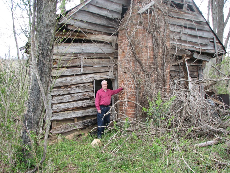
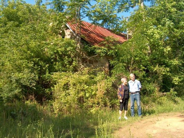
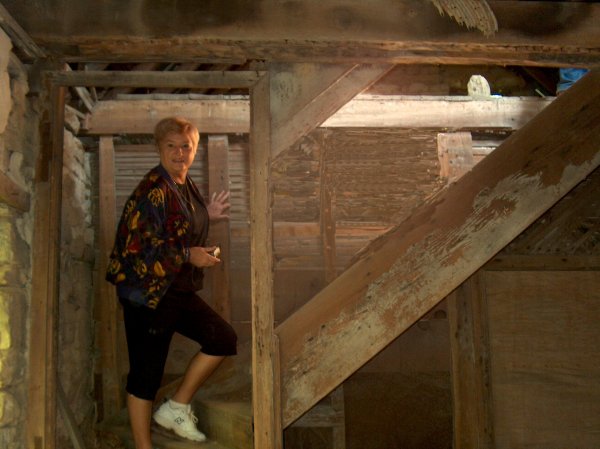
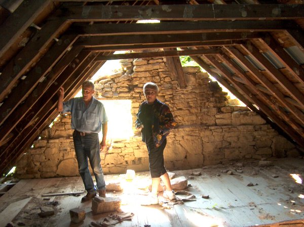
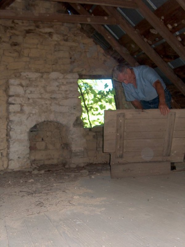
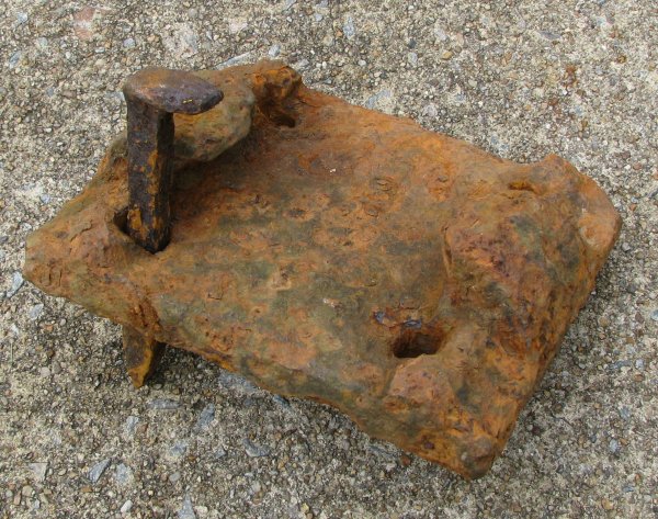 This is the early tie plate with a spike from the cabin. ĀMy grreat grandfather WilliamĀPruett (father of Nathaniel Pruett who was my grandmother Annie Pruett Jones’ father) mentioned his “shops” in his 1876 will.Ā William Puett moved from Pittsylvania to Halifax in the 1850s, so we believe that he may have had a blacksmith shop and forge to produce iron products for the railroad.Ā
 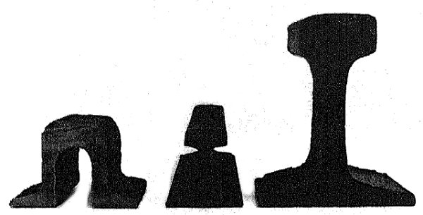 At right is a modern 132-pound/yard rail which is just over seven inches tall.Ā At right are rails used during the Civil War, which are less than four inches tall.Ā At left is a U-Rail and center another early rail.Ā We believe that the U-Rail may have been inserted in the iron tie plate about.Ā During the Civil War, the Richmond and Danville line had 61 miles of 52-pound U-Rail.Ā This is almost half of the 140.5 miles of main track.Ā
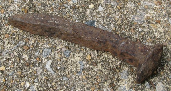 Here is another well worn old railroad spike from the railroad bedĀnear Barksdale Station.
 Here are more iron spikes from the area.Ā The ones at upper left are probably 50 years old.Ā The others are much older.Ā
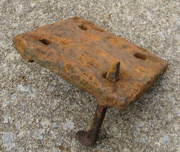
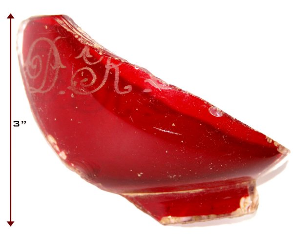
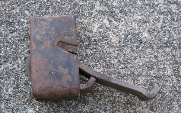 This gadget was by the railroad tracks near the double arched Double Creek bridge trestle.Ā We haven’t figured out what it was used for.Ā (update: Experts tell me this device clamped underneath the track on either side of the wooden tie to keep the track from shifting lenthwise.Ā It is not a old as it looks.)Here is the area from an 1895 map:
 The line from Ringgold to Barksdale, then on to Paces, News Ferry, and South Boston is the Richmond and Danville Railroad.Ā The 140 1/2 mile line was completed in 1856.Ā
 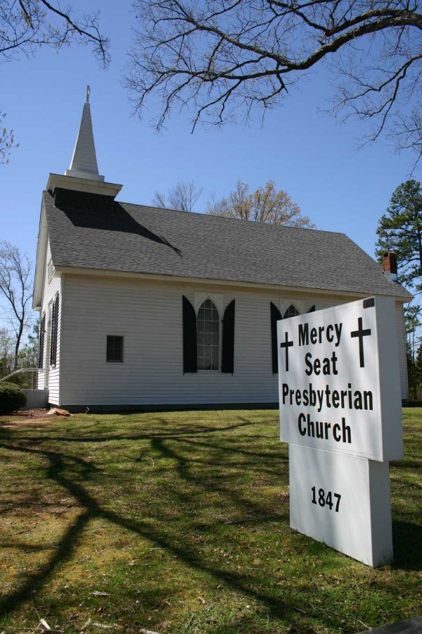 The Mercy Seat Presbyterian Church probably looked about the same when the railroad was being being built in the 1850s.Ā The Pruetts probably went to church here, but I don’t know if they have old records.Ā The original church of the same name was located in the Brooklyn and Elmo.Ā In 1847, a church was reorganized and built in this location near Barksdale Station.
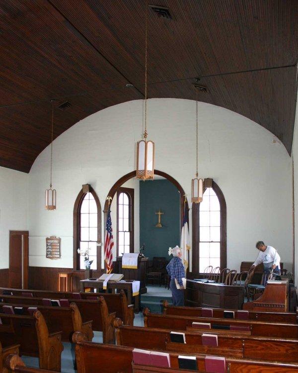 The woodwork in the church is beautiful.Ā I wouldn’t be surprised if the famous Black cabinet maker Thomas Day made these pews.Ā His shop was only about eight miles up Dan River.Ā
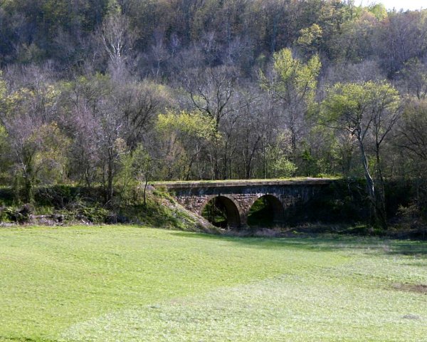 ĀĀĀĀ Construction of the Richmond and Danville Railroad reached Barksdale Station in September of 1855.Ā The 140.5-mile railroad was completed to the depot on Craghead Street in Danville in May of 1856.Ā From Barksdale Station to the Danville Depot is only 13 miles.Ā Before the railroad, the bateaux route through Milton, North Carolina wasĀalmost 24 miles.Ā A freight and passenger depot was constructed at BarksdaleĀa few hundred yards east of the double arched trestle across Double Creek.Ā The trestle is a work of art, with very large cut stones forming the graceful arches above the fast-flowing creek below.Ā It is interesting to note that when the trestle was flanged out to make it higher and wider, some of the old metal tract can be seen jutting out of the concrete above the original top of the bridge.ĀĀOn towards Danville, crossing Sandy Creek there is a trestle with five arches.Ā
 ĀĀĀĀ ĀĀĀĀ Between the bridge and the depot site we picked up shop-made railroad spikes of varying sizes.Ā They appear be original to the 1850s. From the area where we believe the depot was constructed, we found a path on an even grade to the southeast to the Dan River.Ā At the river, where a small branch enters, there was a deep cut out back in the bank.Ā We believe that this may have been the landing for the bateaux, which carried freight to and from Barksdale Station and Milton, North Carolina, which is eight miles upstream.Ā Here’s a ten-minute quick sketch of what we found.Ā Improvements are coming when I get in the Āmood.Ā
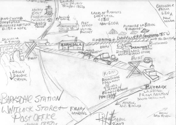
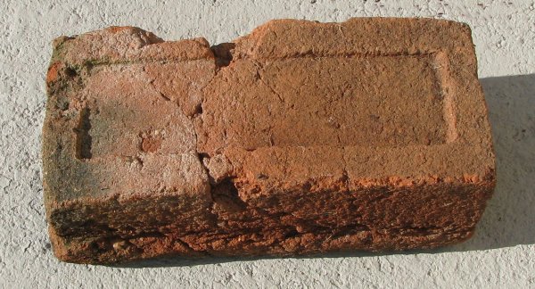 This is an old hand-molded brick from the ruble of the old store.Ā This is typical of the hand-made brick of the area from the 1700s to the mid 1800s.Ā Note at the bottom there is a flange on both sides, which is unusual.ĀĀĀĀĀ The Barksdale DepotĀwas especially important during the War Between the States.Ā The Gen. Robert E. LeeÆs Army of Northern Virginia required large amounts of food and supplies, which came from the south by the Richmond and Danville Railroad.Ā From Milton, in North Carolina, the bateaux could bring tons of supplies from the counties of that state to be transferred to the railroad and hauled to Richmond.


 Ā
Ā

 Ā
Ā